All photos here are copyright protected © 2011 J.A. Delbridge
Updated November 12, 2011
Please send me mail.

Belle Isle is part of the James River Park System in Richmond. There are interpretive signs throughout. This one orients the explorer with the overall layout of Belle Isle.


This is the pedestrian walk that allows access to Belle Isle. It is suspended from the Robert E. Lee Bridge overhead, which opened in 1988, replacing the 1934 Lee Bridge. Along with a friend of mine, back in th '88 we watched the explosive demolition of the older bridge while standing on nearby Oregon Hill. I recall taking my old 35mm SLR camera to take pics of that and the sound was so great, I shook the camera and the pic didn't turn out too well. I'll have to dig up those pics. Anyway, this walkway opened up in 1993. There is also a pedestrian/police vehicle bridge leading from the south side of the river.

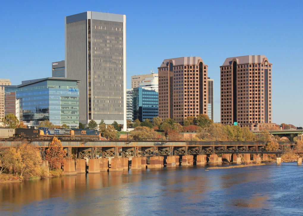
From the suspended pedestrian bridge the view is quite nice of the city skyline and river. You can see I took just a few pics from this vantage point. Lucky enough a CSX freight train full of West Virginia coal was on its way to Newport News to load up the ships bound for countries unknown. If ever you cross the Monitor-Merrimac bridge (I-664) in Newport News/Hampton Roads, you see on the right side the terminus of this coal line as the black heaps get loaded onto ships.


As you walk across the bridge, you notice on the eastern side an old trestle. This seems the style they made b/w 1890 to 1920 or so. I'll have to visit the Library of Virginia to see if I can find info on this bridge. It is interesting to note the difference between this old bridge and the century-newer Lee bridge dominating overhead.


As you step onto the island, this sight makes you really think. It was in this field, now under the towering Lee Bridge, on the eastern tip of the island, where Richmond's Andersonville was located, holding Union prisoners, even in the winter, without shelter from the elements. A sign on the island stated that around 1,000 prisoners died here.


A view looking northward towards where the POW camp used to be, under the current Lee Bridge--it would be interesting to be here in the middle of the night.

click it


While walking along the northern part of the island, I looked up, upriver from Hollywood Cemetery, and I noticed something I never knew existed: a large cross up on the hillside overlooking the James. I need to find out where this is one day. It is too far west to be part of the cemetery (I think).
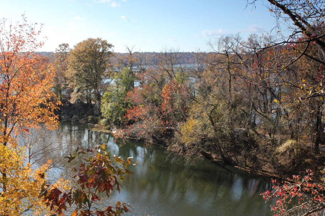
There is a quarry on the island where they dug granite over the centuries. It is now a fishing pond. I took a few pics of it, with the James in the background.


Way up on the hill of Belle Isle looking westward


The famous Hollywood Cemetery, the final home of several U.S. Presidents, Virginia governors, and many others. One day I'll spend a day there taking pics and posting. There are so many stories from Hollywood Cemetery that it will fill a future website of mine. No, it didn't get its name from the more famous Hollywood, since the graveyard was begun back in 1849. I don't believe there were too many movies back then. Little imagination is required to figure out how it received its name (yes, based on the trees), not because of any Tinsel-Town celebrities. Buried here are Presidents James Monroe, John Tyler, CSA President Jefferson Davis, along with 25 CSA generals (ie: George Pickett, J.E.B. Stuart), Virginia Governors (Henry Wise, William Smith, Fitzhugh Lee, John Pollard). More on this historical place later.

Another shot of Hollywood Cemetery that sits on the northern shore of the James, with a dam just below it.

This is a remnant of Virginia Electric Power Company, (VEPCO). Those of us who've been around here a long time still call Dominion Power VEPCO. In 1972, the using the water of the James proved to be too costly compared to using fossil fuels, and later in the decade, nuclear power.

The water flowed through the man-made channel, thanks to the dams erected above the island, and through these grates. This area was tough to keep clear of logs, leaves and other debris from the river.

The VEPCO building where the generators were that made electricity for the electric trolley cars in south Richmond. Did you know Richmond was the first city in the nation to have electric trolley cars?

I initially glanced at this upturned tree without much thought, then something drew me back for a closer look. There is more to this sight than just an uprooted tree. The tree roots, over decades, rooted within what appears to be old railroad ties--the remnants of an old railroad on the island no doubt to help haul iron out of the factories that were once here.

One wall remains of this iron factory building. A sign nearby says mules pulled carts through the arched doorway full of scrap iron from England, that would be formed into nails and other items.

The Ironworks Oil House


The walk back to the north shore of the James. Another CSX coal train under the Lee.


Back on the mainland, my timing was great again as a CSX freight train takes more of our country's coal across one of the Seven Seas.

As I was in Richmond, I wanted to see the western terminus of the old train tunnel that collapsed in 1925 under Jefferson Park. I visited it about 18 years ago and it has changed considerably since then. Back in the '90's I could still see the old rails coming out of the sealed up tunnel and it was just a simple alley between buildings. Now with more money being spent in the city, an apartment complex took over the old Cold Storage building and converted it to high-scale apartments and new secure fencing now surrounds the area with new landscaping. I need to find my old pictures of this angle for comparison. I bought a book on the Church Hill Tunnel Collapse which spurred my visit to this place along 18th street again. See below.

Look closely at the enlarged image, it reads the date they sealed off the tunnel, entombing the large C&O steam engine #231 along with 3 or 4 workers: 1926

Can you find something wrong with the cover of this book? Look closely. I should go buy more copies--are books like trading cards or U.S. coins in that if there is a mistake, the value goes up? Give up? Click on the image.


Our main site: Delbridge.net
